

National Geographic Trails Illustrated Map Steamboat Springs / Rabbit Ears Pass - 9781566953382
Un libro in lingua di Not Available (NA) edito da Natl Geographic Maps, 2007
- € 9.60
- Il prezzo è variabile in funzione del cambio della valuta d’origine
• Waterproof • Tear-Resistant • Topographic Map
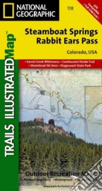
Coverage includes Arapaho and Routt national forests, Sarvis Creek Wilderness, Stagecoach Reservoir State Park, and the cities of Steamboat Springs, Oak Creek and Muddy Pass. Also included are the Yampa River; Dumont, Catamount and Agnes lakes; Stagecoach and Fish Creek reservoirs; the Park Mountain Range; and Rabbit Ears and Yellow Jacket passes. Ski Area coverage includes Steamboat and the Rabbit Ears cross-country area. Includes UTM grids for use with your GPS unit.
Informazioni bibliografiche
- Titolo del Libro in lingua: National Geographic Trails Illustrated Map Steamboat Springs / Rabbit Ears Pass
- Lingua: English
- Autore: Not Available (NA)
- Editore: Natl Geographic Maps
- Collana: Natl Geographic Maps (Paperback)
- Data di Pubblicazione: 01 Gennaio '07
- Genere: Lingua Inglese
- Pagine: 2
- Dimensioni mm: 190 x 107 x 12
- ISBN-10: 1566953383
- EAN-13: 9781566953382