

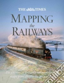
Mapping the Railways - 9780007435999
Un libro in lingua di David Spaven Julian Holland edito da Trafalgar Square, 2011
- € 35.30
- Il prezzo è variabile in funzione del cambio della valuta d’origine
Railways appear in almost every type of map available throughout the nineteenth and twentieth centuries. Detailed Parliamentary plans were drawn up for hundreds of proposed railway schemes (many of which never got past the drawing board). Once built, the Ordnance Survey then plotted the lines onto their national maps of Britain. Cartographers such as John Barthomolew & Son, Cruchley and Bradshaw, were commissioned to draw vast numbers of railway maps during the boom years. Maps were produced as an aid to the management of the railways; to promote the railway companies' networks; and to enable passengers to plan their journeys, then understand the passing scene as they gazed from the carriage window. Thirty mileposts describe the history of the railways; Alongside the maps are a series of "milepost" features which give a detailed description of key events and eras in the history of Britain's railways. The nineteenth century saw the foundations laid for our modern railway network, with huge building projects constructing thousands of miles of track, bridges, and tunnels. This expansion slowed in the early twentieth century as competition from the car and the lorry began to bite. The railways made an enormous contribution to the World Wars, then underwent massive re-equipment after nationalisation, before changing drastically following the famous "Beeching Report" of 1963. The modern era has seen an expansion of the network again, with the Channel Tunnel built, and branch lines closed in the 1960s re-opening for business in the later years of public ownership and the first two decades of the privatised railway.
Informazioni bibliografiche
- Titolo del Libro in lingua: Mapping the Railways
- Lingua: English
- Autori : David Spaven Julian Holland
- Editore: Trafalgar Square
- Data di Pubblicazione: 01 Novembre '11
- Genere: TRANSPORTATION
- ISBN-10: 0007435991
- EAN-13: 9780007435999