- Libreria
- >
- Libri in lingua
- >
- Ingegneria
- >
- Ingegneria elettrica
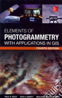
Elements of Photogrammetry With Application in Gis - 9780071761123
Un libro in lingua di Wolf Paul R. Ph.D. Dewitt Bon A. Ph.D. Wilkinson Benjamin E. Ph.D. edito da McGraw-Hill Professional Pub, 2014
- € 151.50
- Il prezzo è variabile in funzione del cambio della valuta d’origine
The new edition of this definitive photogrammetry text covers the latest technological advances in this evolving field.
Essential for students and professionals, Elements of Photogrammetry with Application in GIS covers both the basic foundational principles of photogrammetry as well as important advanced concepts and applications. In the ten years since the previous edition was published, there have been numerous technological advances in photogrammetric sensors and processing methods. Specifically, there has been an increasing shift towards digital imagery, softcopy computer processing, aerial control, and direct georeferencing, as well as an increased use of laser scan mapping. This fully updated edition covers all of these developments.
New to this Edition:
- New chapter on laser scanning (LIDAR) systems
- Coverage of up-to-date imaging systems (large format digital cameras), measuring systems, and modern photogrammetric products
- New material on the integration of GPS and INS (global positioning system and inertial navigation system measurements) and their use in direct georeferencing of images
- Theory, equations, and processing steps for 3-line scan imagery
In-depth coverage:
Principles of Photography and Imaging; Cameras and Other Imaging Devices; Image Measurements and Refinements; Object Space Coordinate Systems; Vertical Photographs; Stereoscopic Viewing; Stereoscopic Parallax; Elementary Methods of Planimetric Mapping for GIS; Tilted Photographs and Perspective Geometry; Introduction to Analytical Photogrammetry; Stereoscopic Plotting Instruments; Topographic Mapping and Spatial Data Collection; Elevated Data Collection by Laser Scanning Systems; Fundamental Principles of Digital Image Processing; Control for Aerial Photogrammetric Projects; Aerotriangulation; Project Planning; Terrestrial and Close-Range Photogrammetry; Introduction to GIS; Photogrammetric Applications in GIS
Informazioni bibliografiche
- Titolo del Libro in lingua: Elements of Photogrammetry With Application in Gis
- Lingua: English
- Autori : Wolf Paul R. Ph.D. Dewitt Bon A. Ph.D. Wilkinson Benjamin E. Ph.D.
- Editore: McGraw-Hill Professional Pub
- Collana: McGraw-Hill Professional Pub (Hardcover)
- Data di Pubblicazione: 07 Gennaio '14
- Genere: TECHNOLOGY and ENGINEERING
- Pagine: 676
- ISBN-10: 0071761128
- EAN-13: 9780071761123


